
A sculpture at the museum. I think it was supposed to be saying that Communism gets rid of the chains of slavery? Or you could view it as pulling the chains tight so that you can't get away.... Either way, the roses were pretty.

A view of the lake

Some interesting words of wisdom....

More interesting translations

No striding?

Dancers after dinner

A little fire breathing

This sign was in my hotel room. I'm not totally sure what they're telling us we're supposed to do with our cash and valuables.

How thoughtful of them! How many times have you been to a hotel and said 'oh no - I've forgotten my underwear and I need to buy some new ones right now. And I'd rather not leave my hotel room to do it!' Also available for purchase in this handy selection was a disposable toilet seat cover and a towel that expanded to full size when you got it wet (super useful idea there).

The restaurant where we had breakfast both days. It was a very Chinese breakfast - some rice gruel a little like watery oatmeal (it's called congee and I think it's kinda gross), some steamed buns with random shredded meat inside, and a hard boiled egg. I had an egg.... And yes, that's part of the kitchen in the background.

The local children attempting to get us to buy random souvenirs at the base of LuoJi mountain on Saturday. We're getting ready to climb to the top (well, sort of). From here we rode a much shorter bus up a bunch of switchbacks, then got on a cable car, then did our hiking.

The kids selling things were everywhere!

View from the bottom of the cable car

Another view from the bottom of the cable car
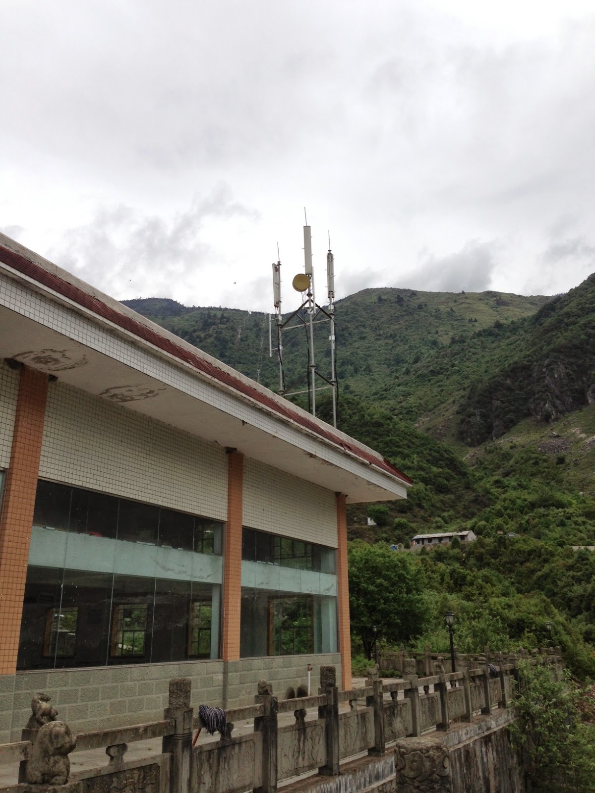
If you look carefully, just to the left of the cell tower is the cable car going up. That's where we're headed. It looks like you'd be at the top of the mountain up there, but trust me, you're not.

The view from the top of the cable car looking back down.

A map of the trails up there. I followed the biggest loop all the way around. The highest point on the hike is at the top of the map.

A Chinese hiking trail. No way you're going to accidentally lose the trail here! And they love their steps....

They want to make sure we remember that we're in nature now. I'll let you guess what they mean by dog ends....

Another great sign to remind us about nature

A view along the hike. The rhododendrons were blooming.

Looking down at the big lake that was near the beginning of the hike.

Hi Mom (and Dad)! I'm really here.... It was raining a bit while we were there, hence the raincoat.

Remember my comment about steps? Here's where we had to go up, and up, and up, and up some more. There were about 12 switchbacks here with nothing but stairs.

The highest point on the hike - 3820 meters (12,533 feet)

The view at the highest point

Time to go back down. Lots more stairs await us - we have to get down past that lake to get to the top of the cable car.
No comments:
Post a Comment